A


Western Interior Seaway (WIS) — Quick Overview
What it was: A vast shallow inland sea that split North America into two landmasses (Laramidia to the west, Appalachia to the east).
When: Mainly during the Late Cretaceous, about 100–66 million years ago.
Extent: Stretched from the Gulf of Mexico north to the Arctic Ocean, covering much of today’s Great Plains.
Why it formed: High global sea levels plus tectonic subsidence related to mountain building (Sevier–Laramide orogenies).
Water type: Mostly marine, but as sea levels fell late in the Cretaceous, parts became restricted, brackish, and even freshwater.
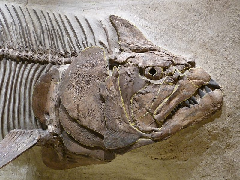
Life: Home to mosasaurs, plesiosaurs, sharks, ammonites, and rich plankton; shorelines supported dinosaurs nearby.
Fossil legacy: Famous fossil beds across Kansas, South Dakota, Wyoming, Montana, North Dakota, and Canada.
Disappearance: Gradual regression as sea levels dropped; fully gone by the end-Cretaceous extinction (66 Ma).
Why it matters: Explains inland marine fossils and how marine predators (like mosasaurs) could later adapt to river systems as the seaway shrank.
No comments:
Post a Comment